Clear Science, Inc. has ceased operations as of 31 December, 2024
CSI Technology Cuts Across All Economic Sectors!
The Advanced Climate Analysis and Forecast - Decision Support System (ACAF-DSS)
- Verticals
- Government
- Agriculture
- Land Management/Wildfire Response
- Insurance/Emergency Managers
- A Few Real-world use cases
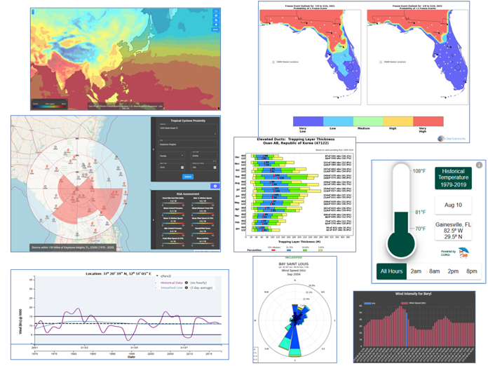
Explore the tabs to see examples of ACAF-DSS technology in action
By exploring the use-cases within the tabs, you will undoubtedly envision hundreds of other application of the DSS technology. The DSS was created from the ground up to suit the needs of many the decision-makers, regardless of the question or challenge. This has resulted in a powerful technology that can serve any sector of the economy to improve:
- Readiness - Knowledge of probabilities of disruptive events ahead of time at all levels to adapt rather than react
- Safety - Arm safety engineers with information to prepare, rather than react
- Event Timing - Reduce risk for high-risk operations
- Maintenance - Plan your maintenance cycle when it makes sense
- Finance/investing - Know the global situation, not just regional, for sophisticated investment decisions
- Enhanced Profitability - When all levels operate better, the bottom line improves
- U.S. Department of Defense and Other Departments
A 20-year History Serving the U.S. Government
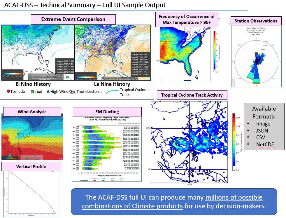
Our technology is firmly rooted in the US Government's need for predictive and forensic information about the global environment. CSI developed the U.S. Navy's enterprise climate analysis tool entitled the Advanced Climate Analysis and Forecast (ACAF) system. To date, CSI has transitions 6 versions of legacy ACAF for use by the DOD, and other department of Government. Today, decision-makers have this tool for better safety, staging, and readiness by having significant foreknowledge of the global atmosphere.
By comparison, however, modern versions of the ACAF, now called the ACAF Decision Support System (ACAF-DSS) are 10x more capable and expandable to support a higher order decision-making.
- Agriculture Use Case
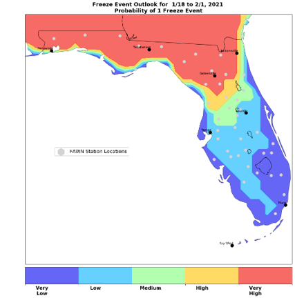
CSI Provides Improved Long-range Freeze Outlook for Florida Growers
The Advanced Climate Analysis and Forecast - Decision Support System (ACAF-DSS) has a pletora of uses within the realm of agriculture. This technology can predict nutrient leeching events, precipitation rhythm, drought, and enable farmers to be better prepared to enhance their readiness for atmospheric fluctuations, and maximize them for profit.
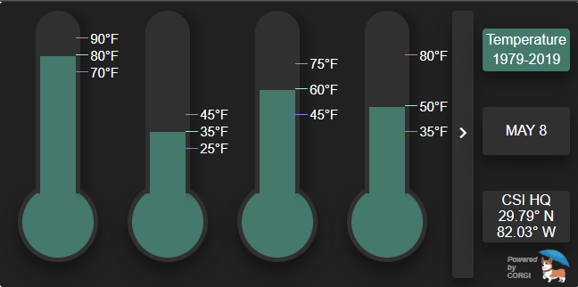
Example: In conjuction with the University of Florida's Institute of Food and Agricultural Sciences (IFAS), CSI poineered a freeze probability outlook (leveraging the ACAF-DSS). This outlook enabled Florida's specialty crop farmers to see the probability of additional freze events throughout the state. The timing of the last seasonal freeze event is absolutely critical to Florida farmers and getting that right can be the difference between a profitable year, or bust.
- Identifying high-risk timeframes east of the Cascades
CSI leveraged the predictive ability of the DSS to assist land managers. This capability was leveraged to extend the prediction time managers had before off-shore winds stoked fires east of the Cascades (West Coast) into major fire events.
By identifying periods of increased probabilities of major fires during the summers months, managers could advise responders and other land owners enhancing their ability to respond, saving thousands of acres of timber.
- A Location-Specific Hurricane Risk Analysis Tool
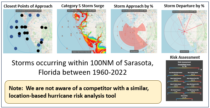
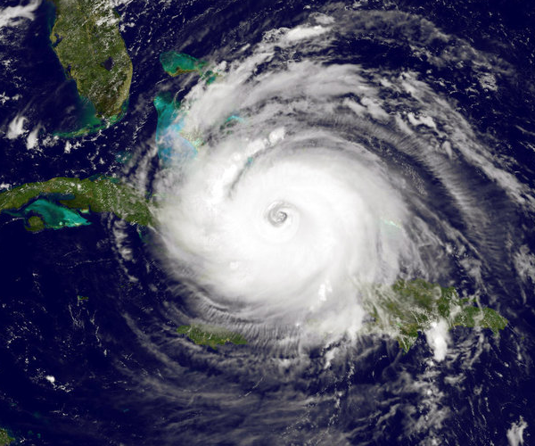
Hurricanes in the US wreak havoc on the economy season after season. If you live in a hurricane prone area, you know how these storms impact your life and business. But what is your actual risk of a hurricane? At what intensity? What month is your greatest risk? The answer to all of those is that it depends on WHERE you are.
CSI used the Advanced Climate Analysis and Forecast - Decision Support System (ACAF-DSS) to create a hurricane risk analysis tool that answers those and many other questions instantly, and based on your location. Numerical risk statistics are calculated that are specific to an address or a map-click that reaches into history to complete your risk picture rather than relying on anecdotal stories or inaccurate news reporting. You can see and evaluate each and every storm passing near your location (radius selection) throughout history, or assess the overall risk based on authority historical datasets.

